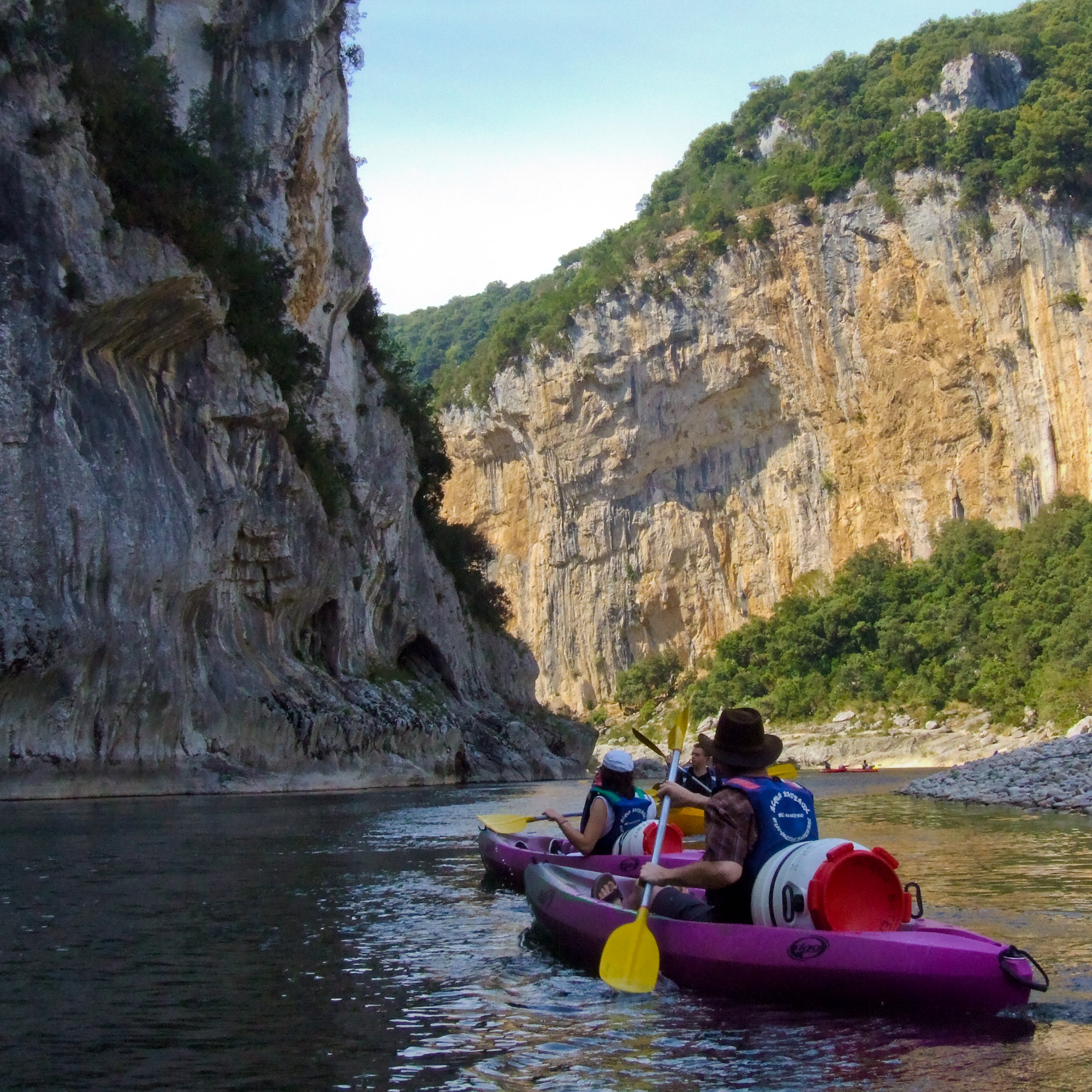
We like to kayak and look for interesting river sections for it when we travel. The Ardèche, a tributary of the Rhone about 120 km long, has carved a deep canyon in the southern French mountain landscape on its way through the karstified rock. The result is a natural spectacle with walls of limestone rock up to 300 metres high.
The photo was taken between Vallon-Pont-d’Arc and Pont-St.-Esprit, a particularly spectacular section with the Gorges de l’Ardèche.
Nous aimons faire du kayak et regarder en voyageant s’il y a des tronçons de rivière intéressants pour cela. L’Ardèche, un affluent du Rhône long d’environ 120 km, a creusé un profond canyon dans le paysage montagneux du sud de la France en traversant des roches karstiques. Le résultat est un spectacle naturel avec des parois de roches calcaires pouvant atteindre 300 mètres de haut.
La photo a été prise entre le Vallon-Pont-d’Arc et le Pont-St.-Esprit, un tronçon particulièrement spectaculaire avec les Gorges de l’Ardèche.
Information about taking this photo
- Camera: FinePix S9500
- Focal length: 8.6mm
- Aperture: ƒ/8
- Shutter speed: 1/250s
- ISO: 200
Where to find this location
If you see this after your page is loaded completely, leafletJS files are missing.
All contents of this website, in particular photographs, are protected by copyright. The copyright is held by Frank Heller/Berlin, unless explicitly stated otherwise. Please ask me if you wish to use the contents of this website. Content published under the "Creative Commons" licence is marked as such. They may be used in accordance with the stated licence conditions. Anyone who infringes copyright (e.g. copies images or texts without permission) is liable to prosecution under sections 106 et seq. of the Copyright Act (UrhG), will also be issued with a warning and must pay damages (section 97 UrhG).